Awards

Manaslu – 2 options/ 24 or 20 days, 5416m or 5235m
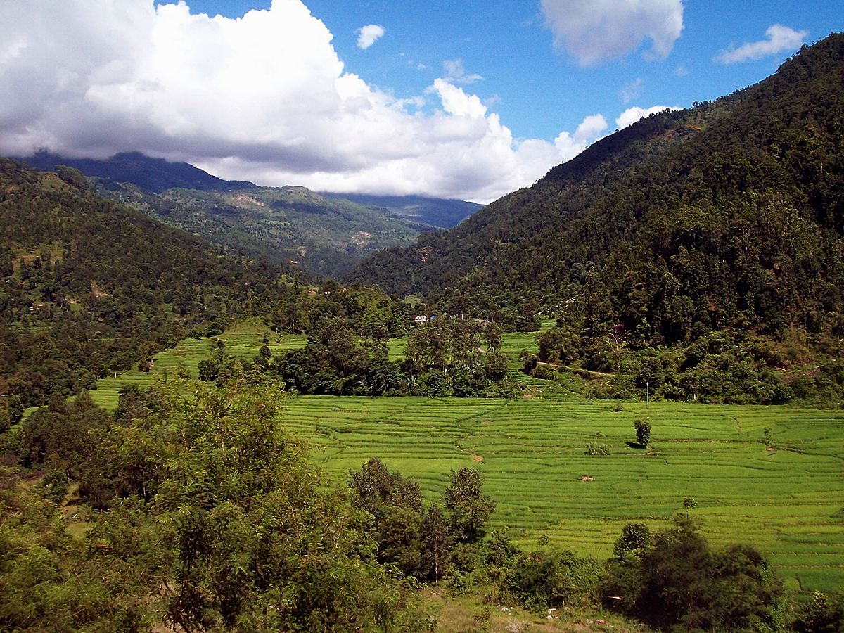
Trekking around Manaslu offers an opportunity to experience unique region with few trekkers which makes a visit here more exclusive and unspoiled. Manaslu trekking provides spectacular beauty along the border of Nepal and Tibet and is now a controlled trekking route, allowing organized trekking groups special permits to gain entry into this region to venture round its spectacular circuit. This trek can be continued also inside Annapurna Region. In this way the trek from Dharapani continues all the way to Manang further to Thorung La Pass (5416m). This trek is finished in Jomsom. Two options are described in the itinerary below: longer and shorter one.
Trip Hightlights:
- Duration: 24/20 Days
- Type of Trek: Teahouse
Nowadays in Manaslu region basic teahouses are available and food is fairly good quality. Tourists also can choose village stay trip. Village stay trip is much cheaper compare to full organize camping trek. In the village stay trek we use tents but we take food from the locals. - Max Altitude: 5416m (I option), 5235m (II option),
- Minimum Pax: 2, maximum: 20
- Mode of travel: Airplane (local airlines, Option I) or land transport (Option II)
- Grade: Severe
Proposal of the itnerary: 2 options
OPTION 1: 24 days, trek to Jomsom at Kali Gandaki river valley crossing which is another high and arduous hike through Thorung La Pass (5416m); finishing the trek by flying to Pokhara (then fly to Kathmandu).
OPTION 2: 20 days, continue descending from Dharapani along the Marshyangdi river valley through the rhododendron & oak forests and finally conclude the trek at Besi Sahar and drive to Kathmandu.
Both options are the same till the 13th day!
(B, L, D – breakfast, lunch, dinner)
 Day 01 – Arrival in Kathmandu, transfer to Hotel, welcome dinner (D)
- Day 02 – Manaslu permit preparation/free day in Kathmandu (B)
- Day 03 – DRIVE TO ARUGHAT BAZAR (640m)
We drive along the Kathmandu-Pokhara highway for the first part of the day. The road gets a bit rough after Gorkha. We will reach Arughat Bazar after seven hours of driving. (B,L,D) - Day 04 – DRIVE BY JEEP TO MACHHAKHOLA (900m) via SOTI KHOLA (775m)
The day we drive north, following the Budi Gandaki. After climbing briefly to Kyoropani we descend to the river and at the confluence with the tributary of Soti Khola. We pass a number of small villages tucked into the hillside, until we reach a widening of the valley, opposite the point where a large tributary stream enters the Budi Gandaki. (B, L, D) - Day 05 – JAGAT (1340m)
We cross the Machha Khola and head upstream to the tiny village of Khola Bensi and the hot springs at Tatopani. The trail is quite exposed and challenging in places. After a short section of forest path we reach Doban. Above Doban the Budi Gandaki descends an impressive series of rapids. At Lauri we will cross the river on a suspension bridge and then climb to Jagat. (B,L,D) - Day 06 – DENG (2085m)
After descending a long series of stone steps to the river, we climb a terraced hill to Saguleri, from where we can see the impressive Singri Himal (7187m). The path splits, with the right-hand branch heading towards the Ganesh Himal while crossing the river at Gata Khola. We finally climb up over a further steep spur to reach the village of Deng. Today we trek for a longer time 7 hours. (B,L,D) - Day 07 – GHAP (2100m)
Next day we cross the village of Lama and we enter Buddhist region. After only about four hours we reach the village of Ghap. We have entered the Tibetan area. There’s a perceptible change in the climate and culture. It gets pleasantly cool, as we start to gain the altitude. (B,L,D) - Day 08 – LHO VILLAGE (3200m)
We move into alpine territory and terrific mountain views. There are 3 more crossings of the Budi Gandaki on our route to Namrung, where our special permit is checked. Climbing gently and crossing a large stream flowing down from the Lidanda Glaciers we reach the Tibetan village of Sho (3000m). As we continue we come to Lho – large village at 3150m. (B, L, D) - Day 09 – SAMA GAON (3500m)
We follow the right bank of the river, with views of Peak 29 ahead. As we continue on the main trail, we soon reach the fields of Sama Gaon (3500m). (B,L,D) - Day 10 – REST DAY
Surrounded by mountains in a peaceful forest we take a rest day to acclimatize and relax. (B, L,D) - Day 11 – LARKYA LODGE “DHARAMSALA” (4500m)
After crossing to the east bank of theBudi Gandaki river we reach the last permanent settlement in the valley, which is called Sumdu. Above the village we cross the stream, which runs down from the Larkya La Pass, the pass to Tibet. We come to the ruins of an abandoned village, known as Larkya Bazar. Nearing the Larkya Glacier we reach our lodge at 4450m. (B,L,D) - Day 12 – CROSS LARKYA LA (5215m) AND TREK TO BIMTHANG (3590m)
We first climb towards Cho Chanda and then slowly head steeply uphill towards the snowed-up pass. From the top the panorama is magnificent: Himlung Himal (7126m), Cheo Himal (6820m), Kang Kuru (6981m) and the Annapurna 2 (7937m). The descent is steep, through moraines, towards Bhimphedi. (B, L, D) - Day 13 – DHARAPANI (1860 m)
A green and densely forested valley lies ahead, sloping down to the distant Marshyangdi river. At Thonje village is our final restricted area check post. We stay in Dharapani for overnight. (B,L,D)
| Option I | Option II |
|
|
|
|
|
|
|
|
|
|
|
|
|
|
|
|
|
|
|
|
|
Galeria